Bureau of Land Management
Solar Energy Permitting and Program Resources
The Approved Record of Decision for Resource Management Plan Amendments for Utility-Scale Solar Energy Development was issued on December 20th, 2024 — details are available on the BLM's Utility-Scale Solar Energy Development PEIS/RMPA webpage. Relevant information on the 2024 Western Solar Plan and the BLM's Renewable Energy Rule issued in July 2024, is in the process of being updated on this website.
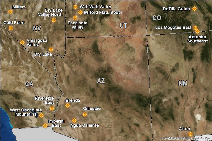
The 2012 Western Solar Plan identified 17 solar energy zones (SEZs) on about 285,000 acres [1,553 km2] of Bureau of Land Management (BLM)-administered lands. These SEZs are identified as Designated Leasing Areas (DLAs) in BLM's leasing regulations (43 CFR 2800). The 2012 Western Solar Plan defined SEZs as areas well suited for utility-scale production of solar energy, where the BLM will prioritize solar energy and associated transmission infrastructure development. The Agua Caliente SEZ (AZ) and the West Chocolate Mountains SEZ (CA) were identified in subsequent planning efforts. A discussion of the criteria used to identify SEZs is provided in Section 2.2.2.2 of the 2010 Draft Solar PEIS (PDF, 790 KB).
The map below shows the locations of the SEZs (current as of 2021). Click the sun icons or labels in the map, or follow the links below the map to learn more about each SEZ.
The 2012 Western Solar Plan further facilitated development in SEZs by establishing:
 Full Resource Map