Bureau of Land Management
Solar Energy Permitting and Program Resources
The Approved Record of Decision for Resource Management Plan Amendments for Utility-Scale Solar Energy Development was issued on December 20th, 2024 — details are available on the BLM's Utility-Scale Solar Energy Development PEIS/RMPA webpage. Relevant information on the 2024 Western Solar Plan and the BLM's Renewable Energy Rule issued in July 2024, is in the process of being updated on this website.
| Arizona Variance Areas | Agua Caliente SEZ |
 |
 |
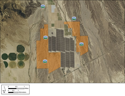
The Agua Caliente Solar Energy Zone (SEZ) is a designated leasing area (DLA) located in southwestern Arizona, in the Lower Colorado Subdivision of Sonoran Desert scrub vegetation community. The SEZ is located on BLM-administered land within the Yuma Field Office.
The Agua Caliente SEZ was established in January 2013 through the Record of Decision (ROD) for the Arizona Restoration Design Energy Project (RDEP), following the requirements of the BLM's Solar Energy Program presented in the 2012 Western Solar Plan. The 2,560 acre SEZ is located near Dateland in western Arizona. The Draft and Final EIS for the RDEP project included detailed analyses and maps for the Agua Caliente SEZ. These analyses supported establishment of this SEZ.
The RDEP Draft EIS identified about 20,600 acres (83.37 km2) for analysis for possible inclusion in the Agua Caliente SEZ. The SEZ boundaries were revised for the Final EIS to include buffers around the major washes; remove the northern portion of the larger SEZ footprint to maintain the area for potential tortoise migration between the Palomas Mountains and Baragan Mountain; and to avoid most known archaeological sites and lands with wilderness characteristics. The total revised area of the SEZ was 2,560 acres (10.32 km2). The RDEP ROD established the smaller SEZ, eliminating sensitive resources and lands.
The Agua Caliente SEZ is located in the eastern portion of Yuma County about 65 miles (104.61 km) northeast of the city of Yuma, and 60 miles (96.56 km) southwest of Buckeye. The SEZ is bordered by BLM lands to the north and west, and state and private lands to the east and south. The Agua Caliente SEZ is located within the Palomas Plain, which is bounded by the Palomas Mountains to the west and Baragan Mountain to the north. Dateland is the largest community in the planning area and is located approximately 12 miles (19.21 km) south of the SEZ along interstate 8. In 2000, the population of the Dateland area was 852.
The primary land cover habitat type in the SEZ is Sonora-Mojave Creosotebush-White Bursage Desert Scrub. Three ephemeral washes in the SEZ support riparian habitat, which may serve as wildlife corridors for species such as mule deer and mountain lion. This area is part of the largest unfragmented habitat remaining in southwest Arizona for bighorn sheep and mule deer. There is a high potential for previously unidentified historic military-related cultural resources to be located in the SEZ due to the U.S. Army's presence in the area during World War II.
The Agua Caliente SEZ is located in an area that is sparsely populated with limited economic development opportunities. The area surrounding the SEZ contains agricultural lands on the east and south sides, and undeveloped desert to the north and west.
Numerous transportation routes traverse the SEZ, most heading north-south and crossing or originating/terminating on private and state land. These routes receive heavy use during hunting season.
Yuma County has some of the highest levels of sunlight (solar insolation) in the U.S., and the county has already attracted significant interest in the development of solar energy.
The nearest major road access to the SEZ is Interstate 8, approximately 12 miles (19.21 km) south of the SEZ. Palomas Road, a Yuma County road, passes just south of and provides access to the SEZ.
A 500-kV east-west transmission line is located approximately 0.5-mile south of the SEZ.
In the 2012 Solar PEIS, the BLM committed to establishing a monitoring and adaptive management strategy for each solar energy zone (SEZ). Through these strategies, the BLM will take an active role in the collection of baseline data for the SEZs.
The BLM has not yet begun the monitoring and adaptive management strategy for the Agua Caliente SEZ. However, the BLM has conducted a pilot monitoring and adaptive management strategy for the Riverside East SEZ. In May 2016, the BLM released the Riverside East Solar Energy Zone Long Term Monitoring Strategy Final Report. The monitoring strategy document (PDF, 16.6 MB) is now available.
In the 2012 Solar PEIS, the BLM committed to preparing solar regional mitigation strategies (SRMSs) for the solar energy zones (SEZs). These regional mitigation strategies were intended to simplify and improve the mitigation process for future solar projects in SEZs.
On March 2, 2016, the BLM released the Regional Mitigation Strategy for the Arizona SEZs – Final Report (PDF, 5.5 MB). The Agua Caliente SEZ is included in the strategy. The strategy identifies mitigation priorities and options in advance of development, and takes into account the resource conditions of the land and regional trends informed by BLM's recent Rapid Ecoregional Assessments. The strategy was developed in collaboration with stakeholders to address key issues such as where and how mitigation may be achieved and the costs associated with doing so.
With IM-2019-018, the BLM established policy that compensatory mitigation could not be required as a condition for project approvals. However, with the issuance of IM 2021-038 on July 14, 2021, the BLM rescinded the previous IM-2019-018. The BLM expects to establish policies which are aligned with EO 13990, SO 3398, and the priorities of the Department. During this interim period offices should consider and implement compensatory mitigation on a case-by-case basis, in consultation with state office and national office program specialists and the Office of the Solicitor as needed.